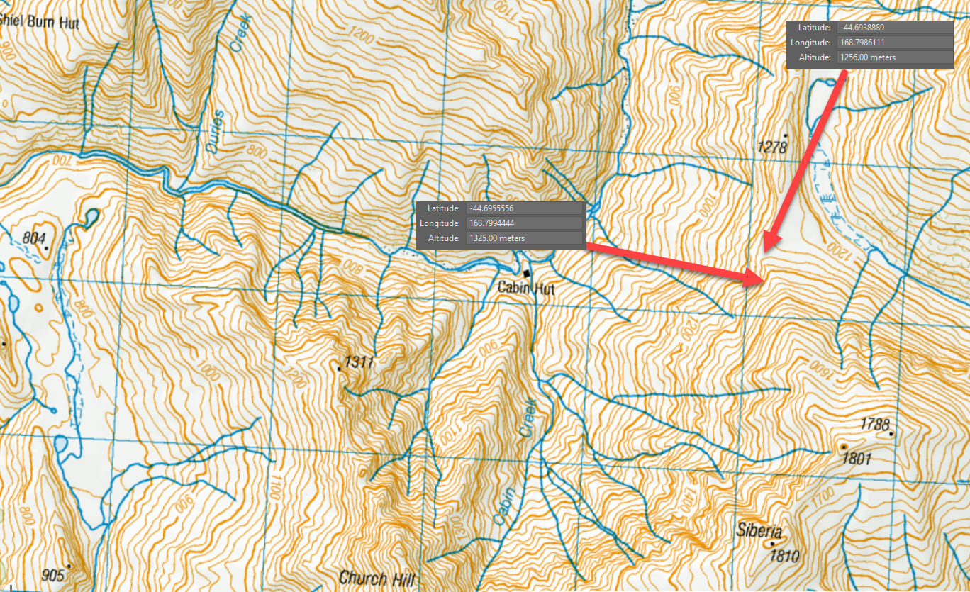
Polnoon Saddle Turk
This is the northern-most Turk, located at the saddle between the Polnoon Burn and Motatapu River’s north branch.
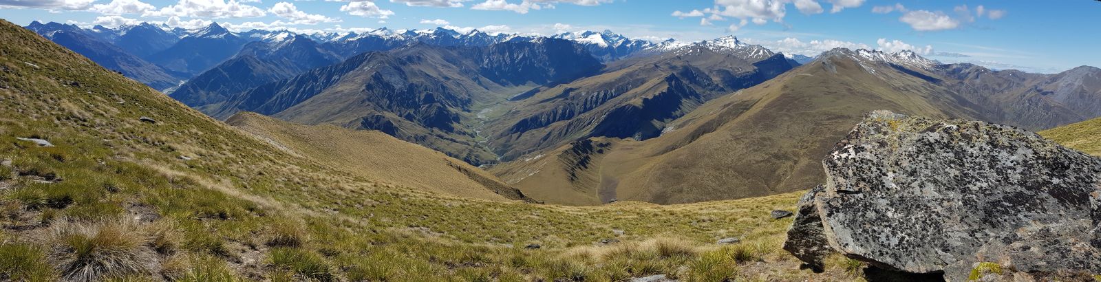
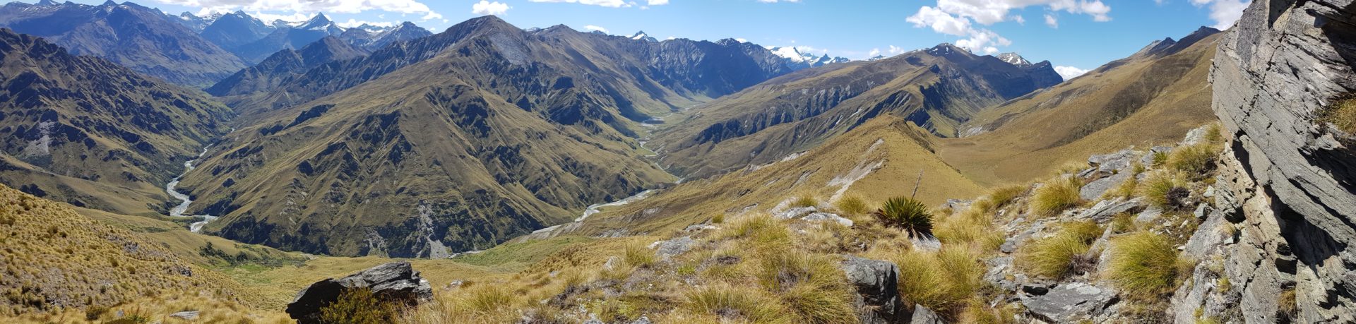
The site has an amazing view looking up the Polnoon Burn and has all day sun. The only concern is the site is potentially windy being the lowest point between large mountains and in line with the north-west winds.
At 1250 metres, the site is higher than the car park at Coronet Peak but much more north facing. Snow will typically stay around the hut for a few days after a storm but most of the year the site will be snow free.